Our Agribusiness GIS project was a software
development and system integration project in which we created a web
front-end for an existing CRM reporting site. Our software provided
a map-based alternative to the customers existing text-based reports.
Our solution featured:
- multiple layers of thematic maps (color-coded and cross-hatched by
regional data values),
- multiple sets of pushpins for information like sales locations,
and
- editable shading / hatching schemes.
- pan, zoom, title & legend control
We used MapInfo's MapXtreme product to generate images of the
agricultural sales and crop yield data in the customer's
database. Our solution was implemented in Microsoft ASP, running on
Windows 2K with IIS 5. We used ADO to retrieve map data from a SQL
Server, and a large amount of DHTML and client-side Javascript for
the color scheme editor on the Internet Explorer client.
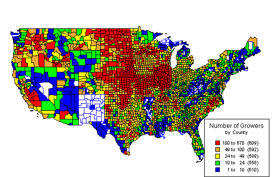
Here's a sample thematic map from our solution:
|